|
 |
|
|
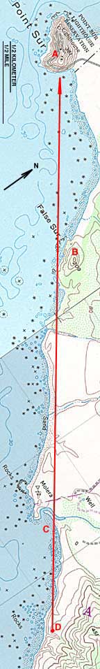
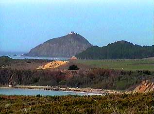
Point Sur, CA - Long Shot This is a very "deep" picture of Point Sur, CA. Scroll down the vertical map to find locations corresponding to A: Point Sur, B: False Sur, C: Molera beach, and D: the camera's location. It's about 3.4 miles (5.4 km) from the camera to Point Sur. The diagonal line at mid-map is a seam between two USGS "quadrangle" maps. The bottom map has UTM grid lines every kilometer (about 2/3 mile). The picture is available with no annotation.
|
|