GPS Receivers
 A GPS receiver can display your position on Earth,
your altitude, speed, direction of travel, and the time of day.
All you need is an inexpensive receiver,
and an unobstructed view of the sky.
A GPS receiver can display your position on Earth,
your altitude, speed, direction of travel, and the time of day.
All you need is an inexpensive receiver,
and an unobstructed view of the sky.
Many factors can determine how accurate a GPS
location is, so it's best to be familiar with
the system, your receiver, and the places you'll be going.
GPS receivers can store a list of your favorite places,
help guide you, even "backtrack" if you get lost.
Better receivers can record
your journey as a "track".
Receivers with a computer interface
let you "download" your collected locations and tracks
to a personal computer using interface cables and software.
You can also "upload" data to prepare for a trip.
 Recreational GPS receivers can cost less than $100,
and are available at outdoor outfitters,
electronics-specialty stores, or by mail-order.
Features and prices vary widely,
so shop around a bit.
If possible, try it before you buy it,
or make sure the seller has a good return policy.
Recreational GPS receivers can cost less than $100,
and are available at outdoor outfitters,
electronics-specialty stores, or by mail-order.
Features and prices vary widely,
so shop around a bit.
If possible, try it before you buy it,
or make sure the seller has a good return policy.
The type of receiver you get can have a great impact
on the quality of the position and tracking data you collect.
A multi-channel "parallel" receiver,
which can listen to many satellites at once,
will be quicker and more accurate than a
single-channel "multiplexing" receiver
listening to one satellite at a time.
You may want to ask about the options available:
an external "amplified" antenna, DGPS receiver,
external power cables,
and personal computer interface cables and software.
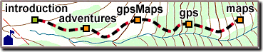
 Built-in maps are nice, but have limited detail.
Maps can add $100 or more to the price of a GPS receiver,
and are not needed to make a printed gpsMap.
Built-in maps are nice, but have limited detail.
Maps can add $100 or more to the price of a GPS receiver,
and are not needed to make a printed gpsMap.
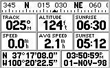
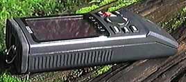
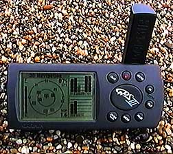
Our screen shots are from a GARMIN GPS-III Receiver
(pictured under "The Global Positioning System").
For information about specific GPS receivers
and how to use them,
ask your outdoor supplier, electronics store,
or contact the receiver manufacturers
or look up their web pages.
|
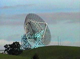
 The Global Positioning System (GPS)
brings a new dimension to the outdoor world.
Some have even called it "The Next Utility".
GPS can enhance the safety, efficiency, and convenience of
all of the ways we get around.
The Global Positioning System (GPS)
brings a new dimension to the outdoor world.
Some have even called it "The Next Utility".
GPS can enhance the safety, efficiency, and convenience of
all of the ways we get around.
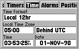 GPS receivers have lots of user-settable options,
so you can work the way you like.
Factory settings may be OK to start with,
but you'll soon find something that needs changing.
User settings for different GPS receivers vary widely,
so be sure to check the manual for the details.
GPS receivers have lots of user-settable options,
so you can work the way you like.
Factory settings may be OK to start with,
but you'll soon find something that needs changing.
User settings for different GPS receivers vary widely,
so be sure to check the manual for the details.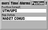 The Universal Transverse Mercator (UTM)
coordinate system is preferred by many GPS users.
Most USGS maps have closely-spaced
The Universal Transverse Mercator (UTM)
coordinate system is preferred by many GPS users.
Most USGS maps have closely-spaced