prev
USGS
next

U.S. Geological Survey

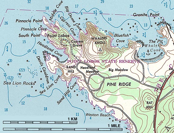
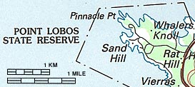
The United States Geological Survey (USGS) has spent more than 100 years making maps. They have large- and small-scale maps covering the US and the world, in great detail and more generally.

There are USGS maps with ecological, mineral, geological, hydrological, cultural, political, economic, and other themes. The USGS also has true-color and infrared satellite pictures, and highway maps, though the average gas station has more useful ones.

Most of the actual mapping is done by the National Geodetic Survey (NGS), part of the National Oceanic and Atmospheric Administration (NOAA). Other NOAA agencies map the skies and waterways.

There are lots of USGS online resources, including an online store where you can order printed and digital maps. NOAA web pages have weather and geophysical information.

Fuzzy Fungus

USGS Topographic Maps

The USGS publishes three main series of large-scale maps, and each has its advantages.

Map
Series
scale approximate
coverage
format detail
7.5 minute 1:24,000 12x10km rolled sheet best
30 by 60 minute 1:100,000 50x80km folded sheet good
1 by 2 degree 1:250,000 110x170km rolled sheet fair

The 7.5 minute maps are richly-detailed large-scale (1:24,000) maps covering about 100 square miles each, on a map about 20 inches wide. The USGS calls this their "primary" map series because they have the most detail. It takes thousands of sheets to cover the country. All states are mapped, but Alaska is covered by a 15-minute series at a slightly smaller scale: 1:63,360.

Because these maps have been produced over many years, there are stylistic and color differences. Some have grid lines, some don't. Some "provisional" maps of remote areas look primitive compared to the detail and color of the main maps.

The 7.5 minute maps are recommended for outdoor recreational use when your travel is limited to a small area. Most of our gpsMaps use 7.5 minute base maps.

Map Samples

Here is a portion of the 7.5 minute map (1:24,000 scale) of Monterey, CA, covering Point Lobos State Reserve. Detail is excellent, but the area of coverage is only about 10 miles wide.


The next map is from the 30 by 60 minute map series. At 1:100,000 scale, it's a good middle scale map covering a larger area. They're readily available, and the detail is great for many uses. This series of map is often folded.


This map is from the 1 by 2 second map series at 1:250,000 scale. These maps have useful contour lines, and cover a very large area in a smaller map, with less detail.

Map Availablility

USGS maps are available from Wild Rose, at many outdoor stores, and directly from the USGS. Our Map-Finder. service can help you select the right maps, and Map Preparation is included in our map prices.

Digital maps are also made by the USGS. They are described on the Wild Rose Digital Maps page.


prev
USGS
next

Map Errors

Because of the complexity of the mapping process, errors are quite common. You might expect an occasional misspelled name or absent landmark, but there are simplified, displaced, or missing roads, trails, and grid marks.

Changes since the map was made are an issue, and property lines, locked gates, and other obstacles can affect your journey.

Base Map errors can affect the accuracy of our gpsMaps. For a well-prepared adventurer, mapping errors shoudn't be a serious problem.


NEXT: You can go to our GPS Hints, information on gpsMaps, or the Wild Home page.


the Wild Rose Website
site map - the Wild Rose website
[home] [introduction] [adventures] [gpsMaps] [gps] [maps]